Train on some territories — test on others
Model validation
The key question for any predictive tool: why should it be trusted? We answer it with spatially independent validation: the model trains on one part of a territory, and its quality is scored on patches fully excluded from training and parameter tuning. Below are the methodology and results of such a test on a gold exploration area of about 4,100 km² in north-east Russia.
Experiment setup
The territory was divided into 6,503 patches (spatial fragments) of 1.92 × 1.92 km. Each fragment is described by 69 feature channels combining multispectral imagery and derived indices, terrain and lineament parameters, airborne magnetic and gravity data, the geological map and radar data. The geochemical block is built from 9,240 samples with 15 elements determined. 856 fragments containing known gold deposits and occurrences are labelled as positive examples.
- 6,503
- patches of 1.92 × 1.92 km
- 69
- feature channels
- 9,240
- geochemical samples · 15 elements
- 856
- known Au occurrences in the labels
Prediction map
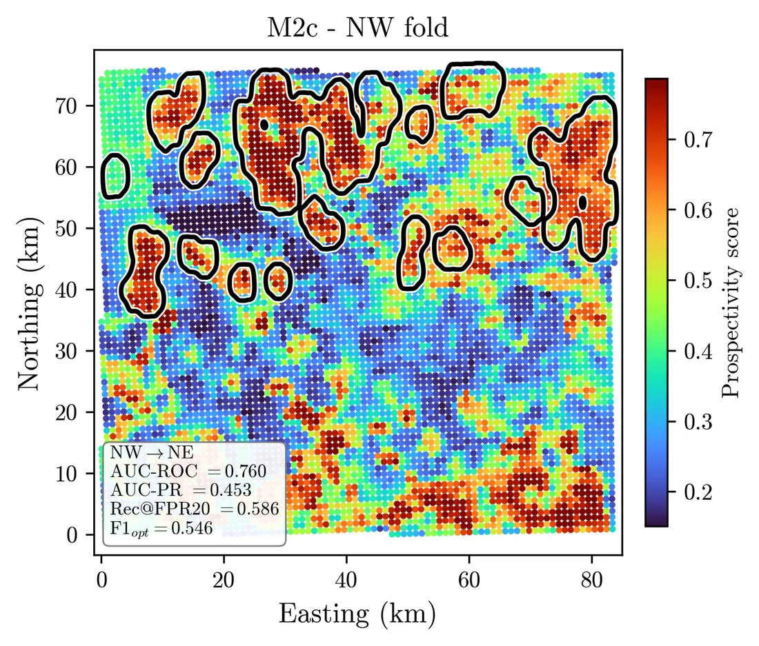
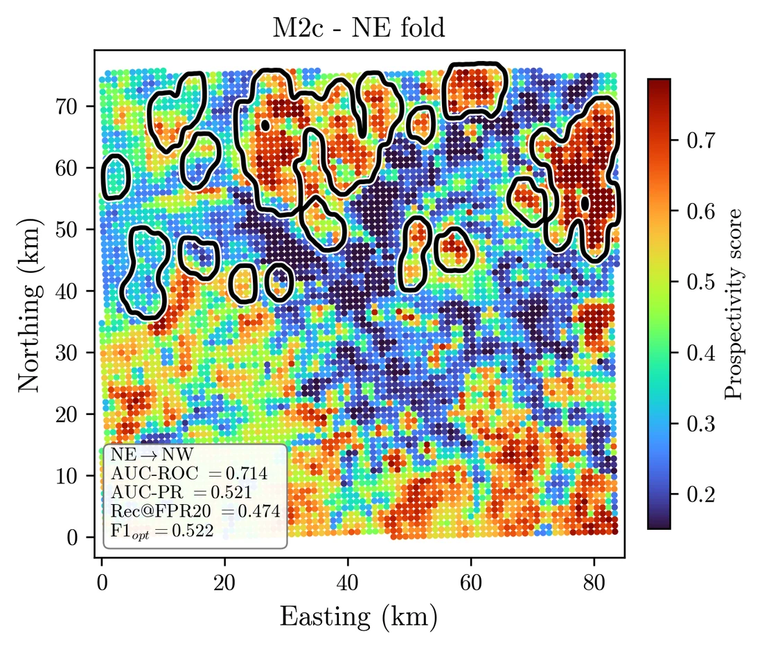
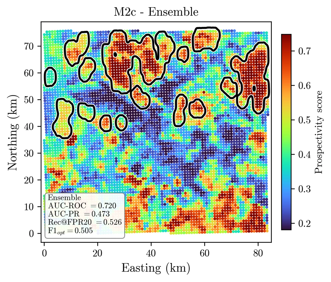
Model M2c (CNN + FiLM): (a) trained on the western half of the territory, (b) on the eastern half, (c) the ensemble. Black outlines are known gold occurrences: a model that never saw an area still reproduces their structure.
Uncertainty map
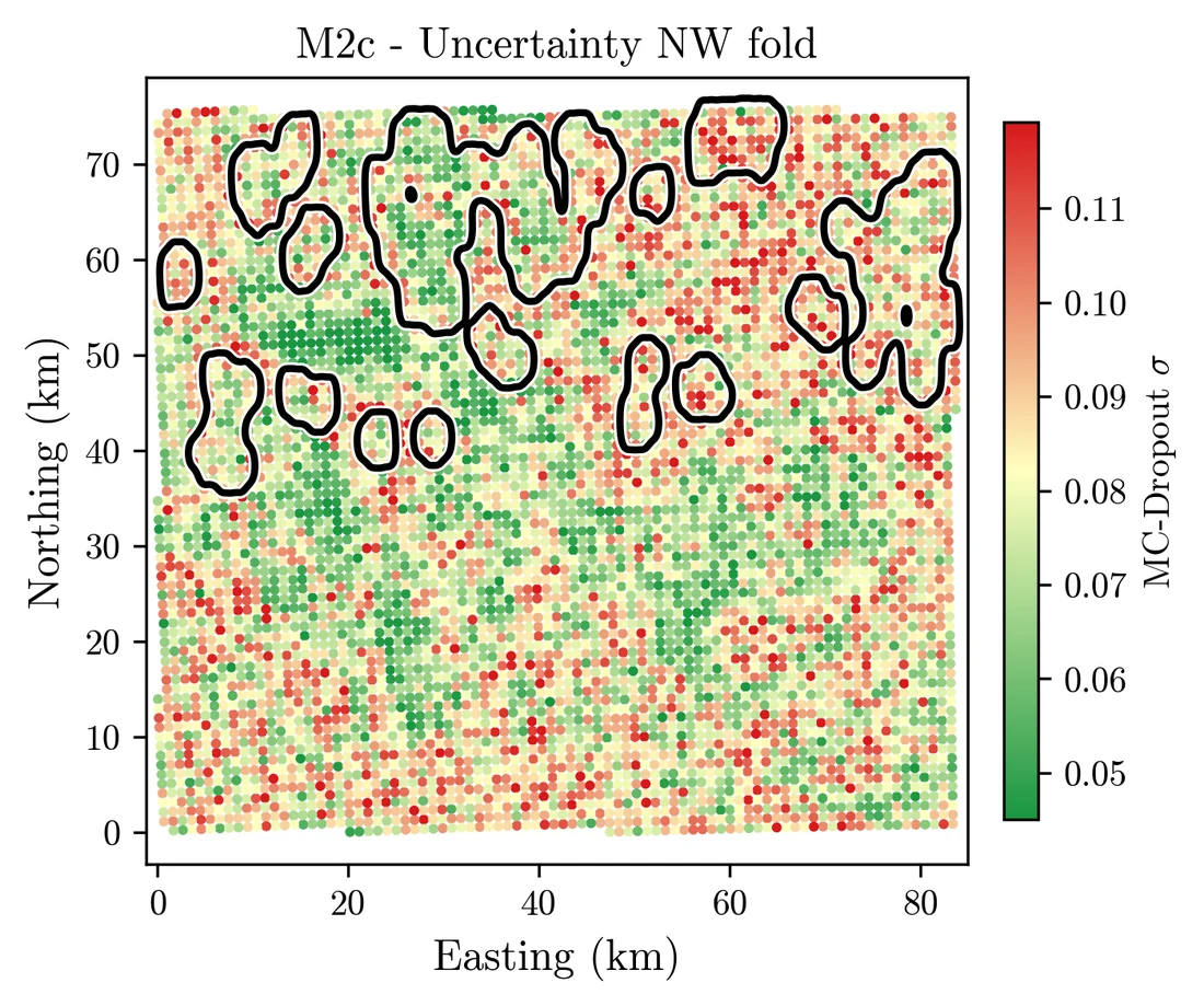
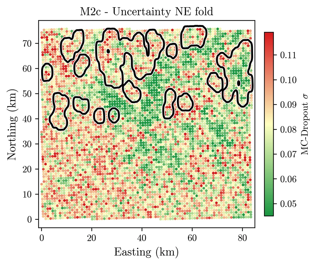
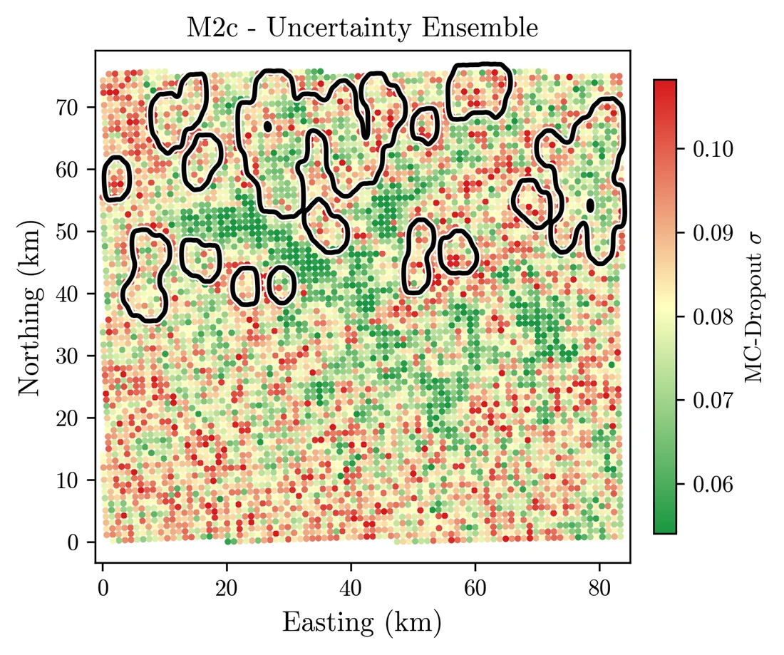
Prediction stability under random dropout of part of the network (MC-Dropout ×20). Low uncertainty on top of a high prediction is a strong validation signal.
Priority index and validation targets
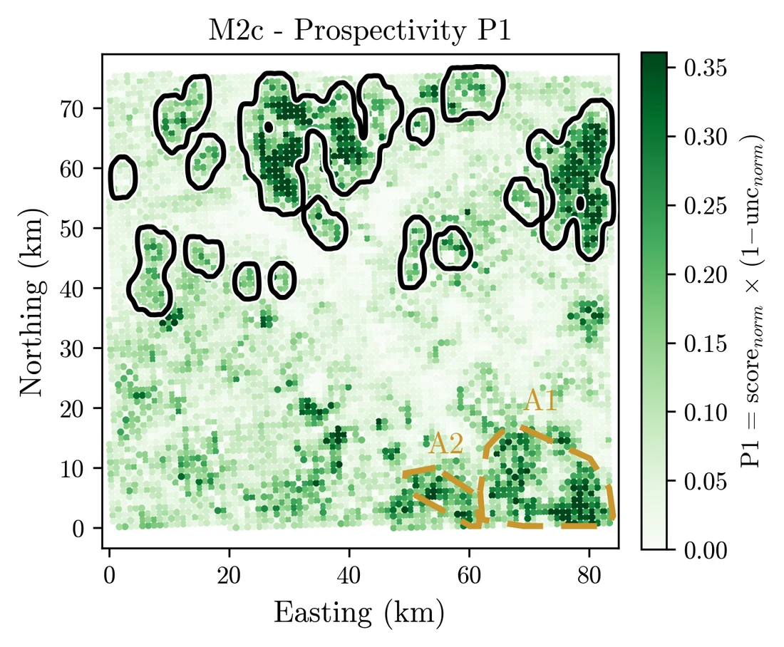
The index combines prediction and confidence: high prospectivity at low uncertainty. Black outlines are known gold occurrences; two southern clusters stand out as first-order targets.
Result
- Ensemble map: AUC-ROC 0.866. A known ore occurrence ranks above a randomly chosen background area in roughly 87 cases out of 100
- Two southern clusters identified: first-order field validation targets
- A ready basis for traverses, sampling and ground geophysics